
| Article number: | APMPRE002L |
| Availability: | In stock (2) |
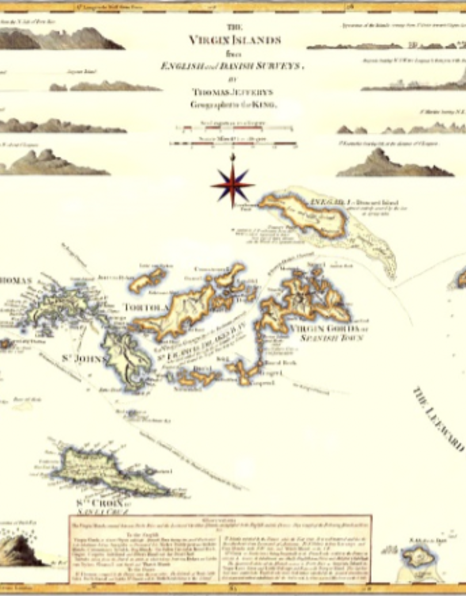
The Virgin Islands from English and Danish Surveys by Thomas Jeffreys - Geographer to King George III. Detailed map of the British Virgin Islands, with the eastern coast of Puerto Rico on the left and some of the islands of the Antilles on the right, including Anguilla, St Maartins, St Bartholomew, Saba, St Eustatia & St Christopher. At the top of the map are coastal profiles. The map was first published in the 'The West-India Atlas' in 1775, making it one of the earliest large-scale maps of the Virgin Islands.
This giclee print is a high-resolution art reproduction printed on acid free paper using archival inks. Image size 24" x 18", comes shipped in a tube.